• Welcome to BirdForum, the internet's largest birding community with thousands of members from all over the world. The forums are dedicated to wild birds, birding, binoculars and equipment and all that goes with it.

    Please register for an account to take part in the discussions in the forum, post your pictures in the gallery and more.
ZEISS DTI thermal imaging cameras. For more discoveries at night, and during the day.

eBird and Birding on the move (1 Viewer)

not true.
Just to give you one example:

These are the 655 entries I made, in the field, with exact coordinates, during 2 weeks of birding in Brazil.
View attachment 1562916

The raw data you get from one trip like this is worth 10x more than any list in ebird.
Just the Bahia Tapaculo spot took me some hours to find the place (based on ebird sightings), thanks to my own field craft and knowledge of habitat requirements, while the GPS point in my observation will enable anyone to go to that spot in minutes.

That's the difference between frustration about badly designed databases (ebird) and efficient ones (observation) while birding some place you're not familiar with.

You can even make a kind of breadcrumb trail by displaying each point on a map (example for one morning, compared that to any list in ebird and the info you get out of it. I remind you: any user can create this from my data, on the website, it's not hidden like tracks on ebird are hidden for viewers). In ebird, this would look like a list with the following info:
1 kilometer, 5 hours, 35 species. Good luck finding the birds at the stake-outs!

View attachment 1562919
But does observation.org allow/create actual checklists? Having a checklist system like eBird is non-negotiable for me. Checklists also include information about absent birds, allowing for bar charts and other tools. I don't want just a bunch of random points when I go birding, but if such a system could be integrated with eBird checklists, that would be even better.
 
But does observation.org allow/create actual checklists? Having a checklist system like eBird is non-negotiable for me. Checklists also include information about absent birds, allowing for bar charts and other tools. I don't want just a bunch of random points when I go birding, but if such a system could be integrated with eBird checklists, that would be even better.
ebird has undisputable advantages with checklists:
1. a checklist is a reference point where you immediately can evaluate whether a bird you consider is rare or not. So checklists help to better evaluate ID in areas where you don't have much experience.
2. hotspots help enormeously sifting out target birds and prepare a trip. All my data (the data I mentioned above) is (also) in ebird, just because I greatly appreciate the targets-per-hotspot feature.

to answer your question:
observation allows you to filter checklists for a certain time frame, i.e. day lists or trip lists. It isn't however, very fancy in doing this and thus not as intuitive / user friendly (or list-orientated) as ebird. So what I said about the checklist advantages (a checklist is a reference point), and what you value (I do as well), isn't in observation. In that way, it's a 'dumb' system the moment you enter data as it doesn't do suggestions and while it has an option to enter 'zero' as a value for birds you haven't seen, it obviously isn't used much.

But, it works a treat once you are in unknown territory and are looking for specific stake-outs for specific target birds. That's where I find ebird sometimes very, very frustating, and sadly I see people that were using observation before on overseas trips, are now using ebird, so while their observation data were incredibly useful, their ebird data are pretty much worthless for my trip preparations.
 
That's the difference between frustration about badly designed databases (ebird) and efficient ones (observation) while birding some place you're not familiar with.

I fully agree. For birders trying to re-find a bird, the Ebird system of huge hotspots, trail and roads is pain to use.

Additionally, most of the past and current Ebird data using hotspots will become useless within few years time for scientific purposes, too. Paths, trails and hotspots change in the field every year. I recently birded in Ghana and Mexico revisiting places described in pre-Covid reports. After 5 to 7 years, forest trails became half farmland and half forest, with the forest starting after several km, where probably birders did not reach 5 years ago. Dirt tracks turned into wide paved roads with intensive traffic etc. Using hotspots after few years is like comparing apples with oranges.

Ironically, Ebird app, Merlin, for the purpose of song identification, collects your detailed coordinates by default, and with the option 'not share the exact coordinates' it still takes coordinates to ca 100m (0.001 degree of the geographical longitude and latitude).

On a practical note, what is the most efficient method of filtering multiple records? When I ask Ebird to show species hotspots, if often turns that interesting records are of people with no experience, so errors / mistakes, and multiple records are often the same day, so a group of 5 everybody put the same observation.
 
I still don't understand how the hotspot system helps in trip planning. As far as I know, there is no way on eBird to list species in a random area, so if I want to find what my targets could be somewhere, I see two options: get a list of species in a country (or maybe province, if I am lucky) or click through dozens of lists of species for individual hotspots.
 
I still don't understand how the hotspot system helps in trip planning. As far as I know, there is no way on eBird to list species in a random area, so if I want to find what my targets could be somewhere, I see two options: get a list of species in a country (or maybe province, if I am lucky) or click through dozens of lists of species for individual hotspots.
You can get a list of species for a hotspot, and filter out target species for that particular hotspot. Ofcourse, you either need a hotspot nearby or a hotspot of a similar habitat (sometimes 100K away, e.g. often this works in the Amazon) so you get a genuine list of species you could target where you are.

So to be clear, ebird is very helpful for statistics (a fairly reliable list of target species in a certain area, with % of occurrence and often relevant info with regards to seasonality, e.g. bar charts, as ebird has a very wide user base and thus, in many places, more than enough data to get solid statistics), but not so much for specifics (where exactly have those target species been seen before).

My main gripe is that ebird has designed their database as a function of those statistics (hotspots / lists) and voluntarily left out two of the most useful feature of any geobased database (exact location, time). They claim you can get a lot of useful scientific data out of ebird data, but I only see them getting out large patterns (migration of common birds in a 1x1K grid for example), and you simply can't get anything useful out of it with regards to linking birds to e.g. (micro) habitat requirements.
 
Last edited:
My main gripe is that ebird has designed their database as a function of those statistics (hotspots / lists) and voluntarily left out two of the most useful feature of any geobased database (exact location, time). They claim you can get a lot of useful scientific data out of ebird data, but I only see them getting out large patterns (migration of common birds in a 1x1K grid for example), and you simply can't get anything useful out of it with regards to linking birds to e.g. (micro) habitat requirements.

I think you've hit the exact point though - as a scientific tool, eBird is designed for macro level projects: the kind that are difficult without an enormous geography of data. Here is a recent study using eBird to investigate subspecies of a sparrow at a rangewide scale: Applying Citizen Science Data to Quantify Differences in Song between Controversial Avian Taxa, the Sagebrush and Timberline Subspecies of the Brewer's Sparrow (Spizella breweri)

Regarding micro-level scales of study, eBird does not replace an individualized study by a university for example - I would argue that it would be a very rare citizen science project indeed that could be ideal for such a thing.
 
You can get a list of species for a hotspot, and filter out target species for that particular hotspot. Ofcourse, you either need a hotspot nearby or a hotspot of a similar habitat (sometimes 100K away, e.g. often this works in the Amazon) so you get a genuine list of species you could target where you are.

Yeah I get that, but this really works well in places like the Amazon, where there are very few hotspots - like in Ecuador, there were like 5 of them in the entire Napo valley. But in densely birded countries, there is a lot of hotspots covering a small area and none of them has all the birds, so you have to click through all of them. Why there can't be a function of "I draw a rectangle on the map, you give me a species list" is really beyond me ...
 
I still don't understand how the hotspot system helps in trip planning. As far as I know, there is no way on eBird to list species in a random area, so if I want to find what my targets could be somewhere, I see two options: get a list of species in a country (or maybe province, if I am lucky) or click through dozens of lists of species for individual hotspots.
There is, but it's obscure:

Why there can't be a function of "I draw a rectangle on the map, you give me a species list" is really beyond me ...
Not necessarily a rectangle; any polygon.
 
I wonder whether Ornitho doesn't combine checklists and exact locations plus also some custom recording schemes (I'm not sure because I don't use it). Still, if you record short checklists or slightly longer ones but without crossing habitat boundaries, eBird's model doesn't lose much in terms of data accuracy.
 
not true.
Just to give you one example:

These are the 655 entries I made, in the field, with exact coordinates, during 2 weeks of birding in Brazil.
View attachment 1562916

The raw data you get from one trip like this is worth 10x more than any list in ebird.
Just the Bahia Tapaculo spot took me some hours to find the place (based on ebird sightings), thanks to my own field craft and knowledge of habitat requirements, while the GPS point in my observation will enable anyone to go to that spot in minutes.

That's the difference between frustration about badly designed databases (ebird) and efficient ones (observation) while birding some place you're not familiar with.

You can even make a kind of breadcrumb trail by displaying each point on a map (example for one morning, compared that to any list in ebird and the info you get out of it. I remind you: any user can create this from my data, on the website, it's not hidden like tracks on ebird are hidden for viewers). In ebird, this would look like a list with the following info:
1 kilometer, 5 hours, 35 species. Good luck finding the birds at the stake-outs!

View attachment 1562919
Maybe eBird's creators thought that if you can be bothered to make sure you have the right coordinates for every species you see, then starting a new checklist every half an hour will require less effort.
 
Maybe eBird's creators thought that if you can be bothered to make sure you have the right coordinates for every species you see, then starting a new checklist every half an hour will require less effort.
Why would you make a checklist every half an hour, birding a trail for hours? You would introduce artificial time stamps and locations for arbitrary lists?
 
It sounds stupid, but it's in their recommendations to record short checklists, and--from a data precision point of view--it makes some sense as well.

EDIT:
Pro Tip: We recommend keeping Traveling checklists under 5 miles (8 km) and Stationary checklists under 3 hours for your sightings to make the biggest impact for science. However, limiting your checklists to less than one hour or one mile provides even more checklist precision!
so every hour should be enough.

For me, it would be less work to start a new checklist every hour than to record the location of every bird (I suppose that wouldn't be back-to-back: I'd, for example, only start a new checklist when I see a bird species I haven't seen on any of the previous one hour long checklists that day).
 
Last edited:
Just the Bahia Tapaculo spot took me some hours to find the place (based on ebird sightings), thanks to my own field craft and knowledge of habitat requirements, while the GPS point in my observation will enable anyone to go to that spot in minutes.
Great, so the_fern can just use Observation, issue sorted. If you really wanted this on Ebird you just make a personal location called Bahia Tapaculo Stakeout and put it as a stationary observation and then anyone searching for that species can quickly access that spot. There are several checklists including one less than 100 meters from your observation that were clearly made at the spot they saw one, I'm sure these are lists you used so you already know that. But I would caution against giving out such high resolution info about an endangered species anyway. It's good to collect it and such info is important for scientific use, but it probably should not be publically available. Personally I wouldn't be comfortable sharing such an accurate location, it's a species right on the edge.

I'm not sure how a sighting works on Observation but if each species at each stop counts as a sighting and you were birding for 2 weeks I take it you weren't logging all individuals as 655 observations doesn't seem particularily high? I did a 15 day trip to Costa Rica and I estimate that logging everything in that style I would have produced several thousand records, far more effort than I would want to expend in logging data. But certainly Observation is better for twitching individual birds and everyone can use whatever app they like, or even just a pen and paper.
 
There is, but it's obscure:


Not necessarily a rectangle; any polygon.
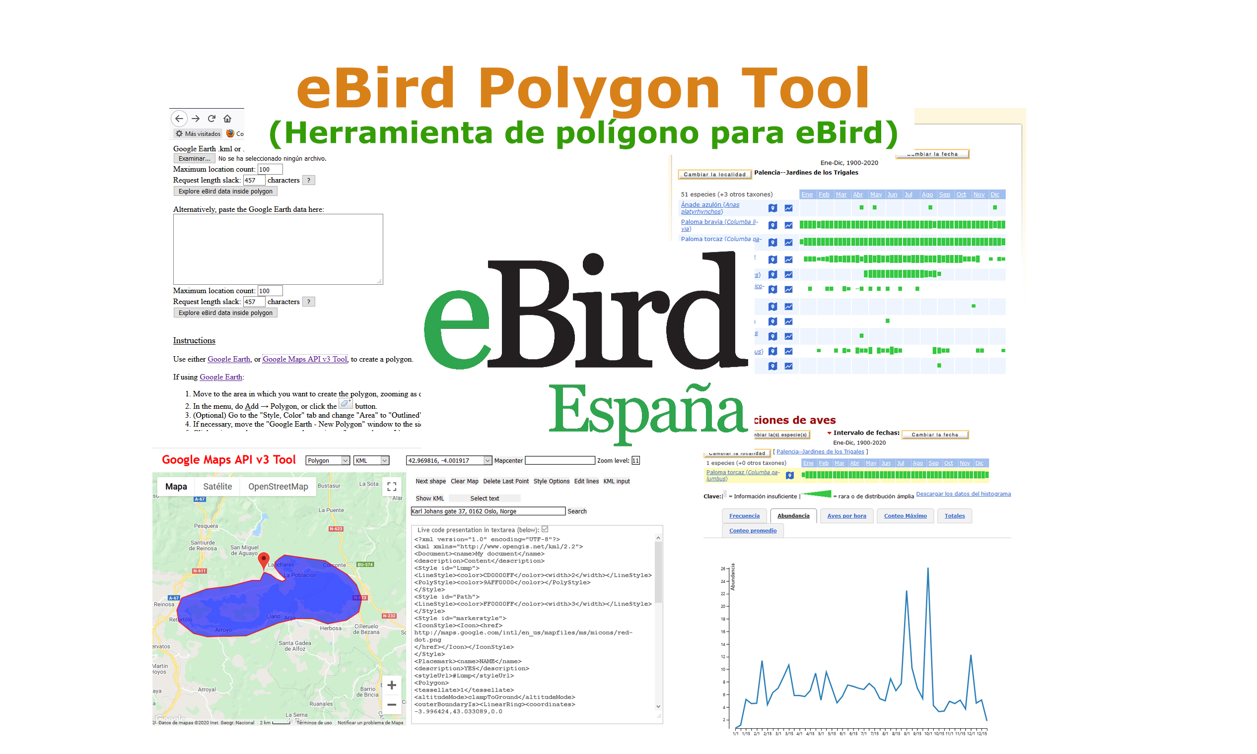
Here's the direct link to the eBird polygon tool. eBird Polygon Tool Note that this is not made by eBird itself. I've long wished that eBird defined hotspots as an area rather than a point. Then all reports to a small hotspot could be fed into the larger hotspot (for example Yellowstone NP--Old Faithful area would feed into an overall Yellowstone NP hotspot). This is how eBird currently handles National Wildlife Refuges, it's rather ridiculous that they don't do this with everything.
 
Great, so the_fern can just use Observation, issue sorted. If you really wanted this on Ebird you just make a personal location called Bahia Tapaculo Stakeout and put it as a stationary observation and then anyone searching for that species can quickly access that spot. There are several checklists including one less than 100 meters from your observation that were clearly made at the spot they saw one, I'm sure these are lists you used so you already know that. But I would caution against giving out such high resolution info about an endangered species anyway. It's good to collect it and such info is important for scientific use, but it probably should not be publically available. Personally I wouldn't be comfortable sharing such an accurate location, it's a species right on the edge.

I'm not sure how a sighting works on Observation but if each species at each stop counts as a sighting and you were birding for 2 weeks I take it you weren't logging all individuals as 655 observations doesn't seem particularily high? I did a 15 day trip to Costa Rica and I estimate that logging everything in that style I would have produced several thousand records, far more effort than I would want to expend in logging data. But certainly Observation is better for twitching individual birds and everyone can use whatever app they like, or even just a pen and paper.

Well, I really wanted this on ebird before I got to search the bird! It seems nobody has bothered to name it a 'Bahia Tapaculo Stakeout' location, and as you never know if a location in ebird is exact, you couldn't have guessed which one is the stake out!

Hindsight is 20/20. Take away the red pointer (that's mine), and tell me where you would go and look for some serious bushwacking, going down a 50 degree slope in order to try your luck, knowing that you don't have 3 days to try and access all of those markers:
1709663155759.png

Before the location where we connected, we tried to access other points and had 'luck' with one of the pointers that was at the top of a vague trail going steeply down the slope. Once down it seemed like the place was throdden, so we tried our luck but no tapaculo was present (or at least: responding to tape). Other points were at the road without indication of a trail going in the forest, so those were obviously just locations that people made (long) before or after they saw the tapaculo and were thus worthless. But we couldn't know before going there and seeing what the markers could be worth: some looked promising (short time / distance in the ebird list) but weren't, others seemed vague (2 of the markers closest to where we connected were 3hours - >1.5km efforts) but turned out to be pretty (not 100%) accurate in the end.

Fact is, you never know, with ebird points, if there is any relevant info within the point as ebird is designed to use one point for a list, not for a bird. So you lump geolocation data (that you could have chosen not to). You could as well close your eyes and point with your finger on the map. I wonder if you ever say to your birding friends: "there is a special / interesting bird, it's somewhere within a 5 km radius and I found it during 5 hours of birding, good luck!"
I find it quite amusing to defend such a system as I am all for 'sharing is caring', but it seems people using a platform sharing sightings are perfectly fine keeping it deliberately vague. Luckily I do know many (even on here) appreciate my trip reports and the exact info that is in there.

If there are good reasons not to share exact info, I'm suppressing the info, but not in the case of a tapaculo that is not suffering the odd tape luring session but rather the relentless destruction of Bahian coastal forests.
 
Last edited:
Fact is, you never know, with ebird points, if there is any relevant info within the point as ebird is designed to use one point for a list, not for a bird. So you lump geolocation data (that you could have chosen not to). You could as well close your eyes and point with your finger on the map. I wonder if you ever say to your birding friends: "there is a special / interesting bird, it's somewhere within a 5 km radius and I found it during 5 hours of birding, good luck!"
I find it quite amusing to defend such a system as I am all for 'sharing is caring', but it seems people using a platform sharing sightings are perfectly fine keeping it deliberately vague. Luckily I do know many (even on here) appreciate my trip reports and the exact info that is in there.

It's as true about eBird as with lots of other tools - many of us have different uses for it with varying degrees of alignment with its core purpose. So yes, there is an "art" to using eBird to find birds and sure its valid to complain when that requires a lot of effort, but we do also need to be cognizant that pointing birders to add to their lists is not the primary purpose of eBird. As you're observing, it can still be used for that purpose, but the locations are spoon-fed to us only if someone has that intention. And the same could be said of other types of bird reports. Its commendable that you include precise details in your trip reports - nobody requires you to do so; but it is your intent. If a reporting mechanism (be it an online geodatabase or your birding friends' conversation) had an intent to give you precise directions you'd get something better than a 5 km precision. But asking a computer code to spit that out for a thousand online observations each day is a bit much - at some point it comes down to users. But asking a thousand users per day to all be good and precise boys and girls every time is a bit much too.

If I were assessing the sightings in this case, I'd be checking each report for what other useful information the observer decided to include - I need to gauge how much effort they put in, how much predictability (vs. luck) their sighting represents, behavior of the bird (singing male on a territory? flyby?), and all kinds of other things as well as the precision and accessibility of the geolocation. You went to a spot with a "cluster" - that is always a good sign.
While I am grateful for your elaborate response, there is no good reason why you couldn't e.g.
1. make a list and start birding;
2. add birds to the list while birding, and have the app register your current location for that addition;
3. allow you to either share that location info in the list or hide it for others (and not for ebird) or hide it alltogether (last 2 options in response to those who think it's a good idea to register vague data because species are endangered, and ebird automatically hides certain species from the list anyway).

In this way, you haven't got any more data and effort than you are already having / making / doing, and you can perfectly control your data (visibility).
For science, you add a whole new layer where you can do studies with regards to e.g. vegetation index vs. species composition (just one example).
You don't have more data, as having a 10-digit XY number is really nothing in terms of extra storage (it's the equivalent of 0.0001 photo added to the list).

All those excuses... I can't take them anymore, they're just very weak. ;)
I'm not sure who or what is being excused - so forgive me if I'm off topic in some way.

But I will add that your proposal sounds to me like different sort of data-tracking than the Google-Maps based system provides with much ease. It was a large effort when eBird added its pathway tracking feature a few years ago. If there were "no good reason" and/or "very weak" reasons for an in-app mechanism for spot-identifying xy locations along this vector trail then I would think it would already have been done by now. I don't think its an issue with data size at all - I think its getting Google Maps to do what you're asking - on a worldwide scale potentially thousands of times per day.
 
While I am grateful for your elaborate response, there is no good reason why you couldn't e.g.
1. make a list and start birding;
2. add birds to the list while birding, and have the app register your current location for that addition;
3. allow you to either share that location info in the list or hide it for others (and not for ebird) or hide it alltogether (last 2 options in response to those who think it's a good idea to register vague data because species are endangered, and ebird automatically hides certain species from the list anyway).

In this way, you haven't got any more data and effort than you are already having / making / doing, and you can perfectly control your data (visibility).
For science, you add a whole new layer where you can do studies with regards to e.g. vegetation index vs. species composition (just one example).
But in order for that to truly work, though, you'd have to enter every single individual bird the moment you see it/hear it. And not just every "good" or "interesting" bird, but every last Blackcap, American Robin, or Tropical Kingbird. And I think only a tiny, tiny percentage of birders would be willing to do that. I know that for me, it would be too much work.

And the problem with analyzing micro-habitats is that the record would be plotted at the spot where you/your device are standing. I'm pretty much always on dry land when I hear a Water Rail calling from a marsh, so what habitat would it be plotted in under such a scenario? And if birding in, for example, Amazonian rainforest, where micro-habitats are things like treefall gaps, liana tangles, small marshy depressions, or bamboo stands, would any such habitats be captured on even the most detailed/high-resolution maps?
 
It's as true about eBird as with lots of other tools - many of us have different uses for it with varying degrees of alignment with its core purpose. So yes, there is an "art" to using eBird to find birds and sure its valid to complain when that requires a lot of effort, but we do also need to be cognizant that pointing birders to add to their lists is not the primary purpose of eBird.
The primary purpose of eBird could be perfectly aligned with what birders like most (not 'art' which is just vagueness, but exact, high-quality info).

But asking a computer code to spit that out for a thousand online observations each day is a bit much - at some point it comes down to users. But asking a thousand users per day to all be good and precise boys and girls every time is a bit much too.
That's what I would call an excuse. You can make visualisation of data faster by aggregating data, and only show detailed data the moment users zoom in beyond a treshold. It can be done.
I'm not sure who or what is being excused - so forgive me if I'm off topic in some way.
see above, but I don't want to 'target' you in particular.
But I will add that your proposal sounds to me like different sort of data-tracking than the Google-Maps based system provides with much ease. It was a large effort when eBird added its pathway tracking feature a few years ago. If there were "no good reason" and/or "very weak" reasons for an in-app mechanism for spot-identifying xy locations along this vector trail then I would think it would already have been done by now. I don't think its an issue with data size at all - I think its getting Google Maps to do what you're asking - on a worldwide scale potentially thousands of times per day.
That system is an improvement, but it isn't visible for users, only for the one who created the list. If google is an issue, there are 'open' map standards as well.
But in order for that to truly work, though, you'd have to enter every single individual bird the moment you see it/hear it. And not just every "good" or "interesting" bird, but every last Blackcap, American Robin, or Tropical Kingbird. And I think only a tiny, tiny percentage of birders would be willing to do that. I know that for me, it would be too much work.
You can e.g. design lists that everything you enter in the field will have coordinates, while everything you add at the end of your walk, is just addition of species. So e.g. you have a walk for an hour and see / hear 10 birds. One of them is a species you monitor in your area, so you enter that one while doing your walk. All others you add when you finish your ebird list. That wouldn't take anything more than the voluntarily effort from the observer to add a bit more detail in the list, about certain species.
And the problem with analyzing micro-habitats is that the record would be plotted at the spot where you/your device are standing. I'm pretty much always on dry land when I hear a Water Rail calling from a marsh, so what habitat would it be plotted in under such a scenario? And if birding in, for example, Amazonian rainforest, where micro-habitats are things like treefall gaps, liana tangles, small marshy depressions, or bamboo stands, would any such habitats be captured on even the most detailed/high-resolution maps?
Well, it wouldn't work for all species and all vegetation types, but it would broaden the possibilities to get something more out of the database...
 

Users who are viewing this thread

Back
Top